Cyber-Secure E-Surveillance: Protecting Cameras and IoT Devices from Digital Attacks
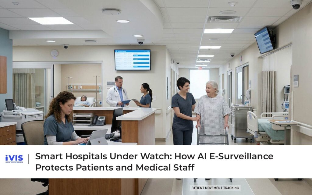
Cyber-Secure E-Surveillance: Protecting Cameras and IoT Devices from Digital Attacks Surveillance systems were once designed to watch the world outside. Today, they must also defend themselves. As organizations adopt cloud-based monitoring, edge analytics, and IoT-connected cameras, e-surveillance has evolved into a highly interconnected digital ecosystem. Cameras are no longer isolated devices; they are networked endpoints, continuously transmitting data, integrating with platforms, and interacting with other systems. This transformation has unlocked powerful capabilities, but it has also created a new vulnerability. Surveillance systems themselves have become targets for cyberattacks. In 2026, securing cameras, video management systems, and IoT surveillance infrastructure is not just an IT concern. It is a critical security priority. The Expanding Attack Surface of Modern E-Surveillance Traditional CCTV systems operated within closed networks. Today’s e-surveillance systems are fundamentally different. They are cloud-connected, API-driven, and integrated with enterprise IT infrastructure. Each connected device like IP camera, network video recorder, sensor, or edge gateway, represents a potential entry point for attackers. According to the Cybersecurity and Infrastructure Security Agency (CISA), IoT devices, including surveillance cameras, are frequently targeted due to weak authentication mechanisms, outdated firmware, and misconfigured networks. Once compromised, these devices can be used for unauthorized access, data exfiltration, or even as part of larger botnet attacks. The scale of the problem is significant. Research from Gartner estimates that billions of IoT devices are now connected globally, expanding the attack surface across industries. Surveillance systems, by their nature, handle sensitive visual data. A breach is not just a technical issue; it is a privacy, compliance, and reputational risk. Common Threats to Surveillance Infrastructure Modern surveillance ecosystems face a wide range of cyber threats. Unauthorized access is one of the most common, often resulting from weak passwords or lack of encryption. Attackers can gain control of cameras, manipulate footage, or disable monitoring entirely. Another growing concern is data interception. Without secure transmission protocols, video feeds can be intercepted, exposing sensitive information. In critical environments such as hospitals, airports, or energy facilities, this can have serious consequences. Malware and ransomware attacks are also increasingly targeting IoT devices. Once inside a network, attackers can disrupt operations or demand ransom for restoring access. Distributed Denial of Service (DDoS) attacks represent another risk. Compromised surveillance devices can be used to launch large-scale attacks, overwhelming networks and causing widespread disruption. The convergence of IT and operational technology (OT) means that a breach in surveillance systems can extend beyond monitoring, impacting entire operational environments. Why Traditional Security Approaches Fall Short Many organizations still rely on conventional cybersecurity measures such as firewalls, antivirus software, and periodic system updates. While necessary, these measures are often insufficient for modern surveillance systems. The challenge lies in the dynamic nature of IoT ecosystems. Devices continuously generate data, interact with multiple systems, and operate in distributed environments. Static security measures cannot keep up with evolving threats. Furthermore, manual monitoring of network activity is impractical at scale. Identifying subtle anomalies in large volumes of data requires advanced analytics. This is where AI-driven cybersecurity becomes essential. AI-Based Anomaly Detection in E-Surveillance Networks Artificial intelligence is transforming how surveillance systems defend themselves. Instead of relying solely on predefined rules, AI models learn normal behavior patterns within networks and devices. For example, a surveillance camera typically follows predictable data transmission patterns, regular streaming intervals, standard bandwidth usage, and known communication endpoints. When deviations occur, such as unusual data spikes or unauthorized access attempts, AI systems flag these anomalies instantly. Research published on arXiv highlights how machine learning models can detect network anomalies with high accuracy, enabling early identification of cyber threats. AI-driven detection provides two key advantages: First, it enables real-time threat identification, reducing response time significantly. Second, it improves accuracy by distinguishing between normal variations and genuine threats, reducing false alarms. This approach shifts cybersecurity from reactive defense to proactive monitoring. Securing Edge Devices and Cameras Edge devices are at the heart of modern e-surveillance. Cameras now process data locally, enabling faster analytics and reduced latency. However, this decentralization also introduces new risks. Each edge device must be secured individually. This includes strong authentication mechanisms, regular firmware updates, and encrypted communication channels. According to National Institute of Standards and Technology (NIST), securing IoT devices requires a lifecycle approach; covering device onboarding, operation, maintenance, and decommissioning. Best practices include: Implementing zero-trust architectures where every device must be authenticated continuously Using end-to-end encryption for video and data transmission Regularly updating firmware to patch vulnerabilities Segmenting networks to prevent lateral movement of attackers These measures ensure that even if one device is compromised, the impact remains contained. Cloud Security and Data Protection As surveillance systems migrate to the cloud, securing data becomes even more critical. Cloud platforms offer scalability and centralized management but also introduce new attack vectors. Data stored in the cloud must be encrypted both at rest and in transit. Access controls should be role-based, ensuring that only authorized personnel can view or manage surveillance data. The International Organization for Standardization (ISO) outlines frameworks such as ISO/IEC 27001 for information security management, which are increasingly adopted by organizations deploying cloud-based surveillance systems. Compliance with these standards not only enhances security but also builds trust with stakeholders. The Convergence of Cybersecurity and Physical Security One of the most significant trends in modern surveillance is the convergence of cybersecurity and physical security. These domains were traditionally managed separately, but they are now deeply interconnected. A cyberattack on surveillance systems can lead to physical security failures, disabled cameras, manipulated feeds, or delayed responses. Conversely, physical breaches can expose network infrastructure. This convergence requires a unified approach to security, one that integrates IT, OT, and surveillance systems into a cohesive framework. The World Economic Forum emphasizes that protecting critical infrastructure requires coordinated strategies that address both digital and physical risks simultaneously. The Role of IVIS in Cyber-Secure E-Surveillance As surveillance ecosystems grow more complex, organizations need platforms that integrate security at every level. This is where IVIS plays a critical role. IVIS is designed with a security-first architecture that addresses both operational and cyber risks. It enables centralized monitoring of surveillance networks while incorporating AI-driven analytics to detect anomalies in real time. By integrating video analytics with cybersecurity monitoring, IVIS helps organizations identify unusual patterns, whether in device behavior, data transmission, or access activity. This dual-layer intelligence ensures that both physical and digital threats are addressed simultaneously.