Eyes in the Sky: The Expanding Role of Drone Surveillance in Modern Conflicts
The image of surveillance has traditionally been associated with fixed cameras, control rooms, and ground-based monitoring systems. Yet over the past decade, a new vantage point has reshaped how intelligence is gathered: the sky. UAVs (Unmanned Aerial Vehicles), which are commonly known as drones, have become one of the most transformative surveillance tools in modern warfare.
From missions to real-time battlefield monitoring, drones provide persistent intelligence that was once difficult, expensive, or dangerous to obtain. Conflicts across the world, including the evolving tensions between Israel and Iran, have demonstrated how drones enable rapid situational awareness and data-driven decision-making. But their significance extends far beyond the battlefield.
Technologies developed for drone surveillance in military environments are increasingly influencing civilian sectors such as border security, disaster management, infrastructure inspection, and industrial monitoring. In many ways, drones represent the next frontier in e-surveillance, delivering intelligence from above while integrating seamlessly with ground-based systems.
The Rise of Drone Surveillance in Modern Warfare
Modern conflicts increasingly rely on information superiority. Knowing what is happening across vast territories in real time can determine strategic advantage. Traditional reconnaissance methods like satellite imagery or manned aircraft, remain important but come with limitations such as cost, delay, or operational risk.
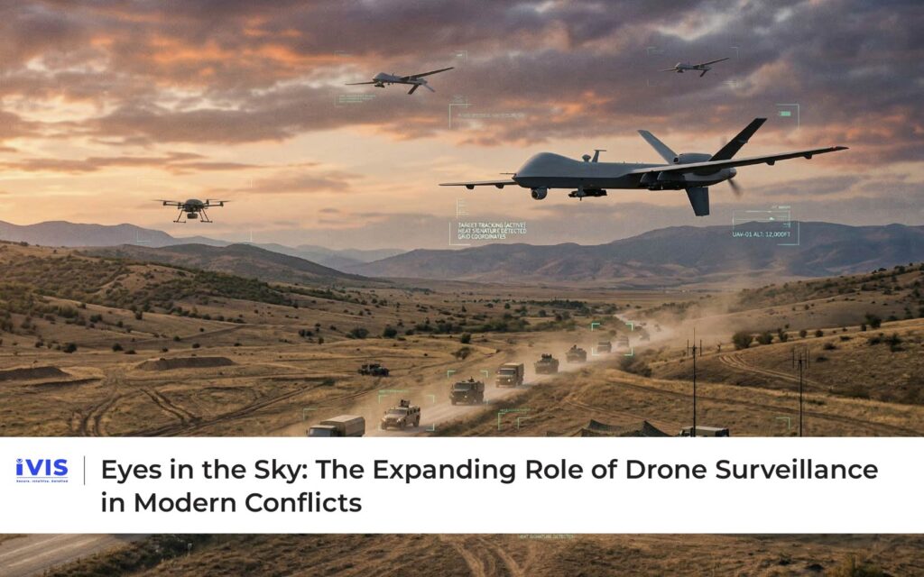
Drones address these limitations by offering continuous, low-risk monitoring. Equipped with high-resolution cameras, infrared sensors, and advanced communication systems, drones can capture detailed imagery and transmit it instantly to command centers.
According to research from the Center for Strategic and International Studies, unmanned aerial systems have become a central component of modern military intelligence, surveillance, and reconnaissance (ISR) strategies. They enable persistent observation of sensitive areas while reducing risk to human personnel.
In conflicts across the Middle East, drones have been used to monitor troop movement, assess infrastructure damage, and gather intelligence on strategic assets. Their ability to remain airborne for extended periods and provide live data streams has significantly improved operational awareness for military planners.
Real-Time Intelligence and Data Analysis
The true value of drone surveillance lies not only in capturing imagery but in the ability to analyze data rapidly. Modern drone systems integrate artificial intelligence and computer vision algorithms that can identify objects, track movement patterns, and flag unusual activity.
For example, AI-powered analytics can distinguish between vehicles, personnel, and equipment in aerial imagery. When combined with geospatial data and machine learning models, these systems help analysts identify anomalies, such as unexpected movement in restricted areas or sudden changes in infrastructure.
Research published in IEEE journals highlights how AI-based aerial surveillance systems significantly enhance detection accuracy compared to manual analysis. By automating object recognition and pattern detection, drones transform raw visual data into actionable intelligence.
This capability is particularly important in dynamic conflict environments where decisions must be made quickly and information must be continuously updated.
Drone Surveillance and Multi-Sensor Intelligence
Modern military surveillance rarely relies on a single source of data. Instead, intelligence systems combine information from multiple platforms – satellites, drones, ground sensors, and electronic signals.
Drones play a crucial role in this multi-sensor fusion ecosystem. While satellites provide large-scale geographic coverage, drones deliver detailed, localized imagery. Ground sensors contribute additional environmental data, such as movement or heat signatures.
By integrating these sources, surveillance platforms create a comprehensive operational picture. Command centers can monitor activity across different altitudes and distances simultaneously, improving both situational awareness and strategic coordination.
This model of integrated intelligence is increasingly influencing civilian surveillance systems as well.
Beyond the Battlefield: Civilian Applications of Drone Surveillance
Technologies developed for military drone surveillance are rapidly finding applications in civilian environments. Governments, enterprises, and infrastructure operators are adopting drones for a wide range of monitoring tasks.
Drones provide an efficient method for monitoring large border regions that are difficult to patrol continuously. Equipped with night-vision cameras and thermal sensors, drones can detect unauthorized crossings, track movement in remote terrain, and support border patrol operations. Many countries are already integrating drones into border surveillance systems to complement ground-based monitoring technologies.
During natural disasters, traditional surveillance infrastructure may be damaged or inaccessible. Drones can quickly survey affected areas, identify survivors, and assess infrastructure damage. The World Bank notes that aerial imagery captured by drones significantly improves disaster response planning by providing accurate, real-time situational data. Emergency teams can prioritize rescue operations and allocate resources more effectively.
Industrial facilities, pipelines, power plants, and construction sites often span large or hazardous environments. Drone surveillance allows operators to inspect infrastructure safely without exposing personnel to risk. High-resolution cameras and thermal sensors can detect structural defects, equipment overheating, or environmental hazards. These insights help organizations prevent failures and reduce maintenance costs.
Drone Surveillance and Smart Infrastructure
As cities and industries adopt smart technologies, drone surveillance is becoming part of broader e-surveillance ecosystems. Urban command centers increasingly combine aerial data with ground-based camera networks, IoT sensors, and predictive analytics.
For example, drones can monitor large public events, assess traffic congestion, or inspect transportation infrastructure. In smart city environments, aerial monitoring enhances the ability of authorities to manage dynamic situations quickly.
The World Economic Forum has highlighted how integrating aerial surveillance with intelligent analytics can significantly improve public safety and urban resilience.
Ethical Considerations and Responsible Deployment
While drone surveillance offers powerful capabilities, it also raises important ethical and regulatory questions. Monitoring from the air can capture large volumes of visual data, potentially affecting privacy and civil liberties.
International guidelines emphasize the need for transparency, proportionality, and accountability in the use of surveillance technologies. UNESCO’s Recommendation on the Ethics of Artificial Intelligence highlights the importance of human oversight and responsible data governance in AI-driven monitoring systems.
Governments and organizations must therefore implement safeguards such as secure data storage, controlled access, and clearly defined operational policies. These measures ensure that drone surveillance enhances safety without undermining public trust.
The Role of IVIS in Drone-Enabled Surveillance Ecosystems
As aerial monitoring becomes more widespread, organizations require platforms capable of integrating drone data with existing surveillance systems. This is where IVIS plays a significant role.
IVIS in collaboration with Scanalitix, provides a unified surveillance intelligence platform that can combine inputs from multiple sources, including fixed cameras, IoT sensors, and drone feeds. By applying AI-powered analytics to these datasets, IVIS enables real-time monitoring and anomaly detection across large geographic areas.
For infrastructure operators, emergency responders, and security agencies, this integrated approach enhances situational awareness. Drone imagery can be analyzed alongside ground-based surveillance to identify emerging risks and coordinate rapid responses.
IVIS also supports scalable deployment models, allowing organizations to extend surveillance coverage dynamically when drones are deployed in the field. With built-in governance controls and audit capabilities, the platform ensures that advanced surveillance technologies remain compliant with regulatory and ethical standards.
Through this integration, IVIS transforms drone surveillance from a standalone capability into a critical component of modern e-surveillance ecosystems.
The Future of Drone Surveillance
The trajectory of drone surveillance is closely linked to advancements in artificial intelligence, sensor technology, and communication networks. As these technologies evolve, drones will become even more autonomous and capable.
Future systems may feature AI-driven navigation, collaborative drone fleets, and enhanced edge computing capabilities that process data directly on the device. Integration with 5G networks will enable faster data transmission and real-time analytics.
As these innovations mature, drone surveillance will likely expand into additional sectors, including environmental monitoring, agricultural analysis, and large-scale infrastructure management.
The “eyes in the sky” that once served purely military purposes are increasingly becoming a central element of civilian intelligence and operational oversight.
Conclusion
Drone surveillance has emerged as one of the most transformative technologies in modern intelligence gathering. In conflict zones, it enables persistent monitoring and rapid decision-making. In civilian environments, it supports border security, disaster response, and infrastructure protection.
As these capabilities continue to evolve, integrating aerial intelligence with ground-based surveillance systems will become increasingly important. Platforms like IVIS demonstrate how advanced analytics and data integration can turn aerial imagery into actionable insights for both security and operational efficiency.
The sky is no longer just a vantage point, it is an integral layer of the modern surveillance ecosystem.